How Flash Flood Forecasting is Evolving in Europe
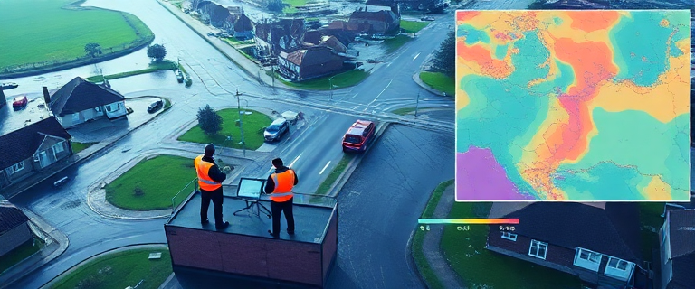
Flash floods in Europe strike with little warning, turning streets into fast-moving torrents and threatening lives, infrastructure, and essential services. To shorten warning times and boost resilience, two Europe-wide initiatives—Echo Flash and the FlashFloodBreaker project—are extending lead times and strengthening preparedness across North‑West Europe. They rely on transnational collaboration, rapid crisis awareness, and advanced forecasting techniques that connect science to action for communities, authorities, and responders.
Understanding Flash Floods
A flash flood is a rapid rise of water in normally dry areas, typically triggered by intense rainfall over short periods. The rise is exceptionally fast: many flash floods develop within 3 to 6 hours after heavy rainfall, leaving little time for protective actions. In recent history, Europe has faced notable flash flood events in July 2021 across Germany, Belgium, the Netherlands, France, Ireland, and Switzerland, underscoring the need for timely, actionable warnings that can inform evacuation, road closures, and resource deployment.
Echo Flash: Daily Snapshot Service
Echo Flash is a daily snapshot service designed to support humanitarian crisis awareness with speed and neutrality. Each day, Echo Flash provides concise summaries of unfolding disasters and major humanitarian crises in Europe and around the world. The format is intentionally plain and factual, delivering quick updates in simple language that emphasize the added value of DG ECHO (Directorate-General for European Civil Protection and Humanitarian Aid Operations).
Echo Flash communicates a rapid, readable briefing that helps humanitarian teams, decision-makers, and partners stay informed without delay. It is not a dynamic forecast tool by itself, but it complements forecast-based risk management by keeping frontline responders and planners aware of ongoing conditions and evolving needs. In this way, Echo Flash supports timely decision-making as part of a broader early-warning ecosystem.
FlashFloodBreaker: Extending Lead Times for Flash Flood Warnings
The FlashFloodBreaker project aims to push the boundaries of flood forecasting in North‑West Europe by extending warning lead times from the current 1–4 days to a 4–10 day horizon. It targets urban areas, polder landscapes, and steep valleys—zones that are particularly vulnerable to flash flood and pluvial flood risks where conventional protection measures may be limited by land-use constraints. The overarching objective is to make North‑West Europe more resilient to extreme flash flood events by empowering authorities, crisis managers, and local residents to anticipate and act with greater lead time and accuracy.
By project end, it seeks to deliver a cohesive regional strategy for North‑West Europe and actionable plans to manage flash flood risks more effectively. It intends to pilot six integrated solutions that model flash floods and predict them in real time, with the aim of protecting people, infrastructure, and economic activity while enabling better warning, preparation, and rescue operations. Additionally, the project includes training for 500 participants—comprising crisis unit members, residents, and students—to anticipate and respond appropriately to extreme flood events.
Crucially, FlashFloodBreaker embodies transnational collaboration—an approach that seeks to transfer knowledge and validated practices across borders. By testing and validating models in different territorial contexts, the initiative strives to harmonize forecasting practices, improve cross-border emergency response, and promote shared resilience in a region facing increasing extreme weather due to climate change.
Target Regions and Risk Areas
FlashFloodBreaker focuses on seven risk-affected areas in North‑West Europe where conventional flood protections are insufficient to meet rising risk. These regions were chosen because they combine urban development with land-use features that create vulnerable conditions during heavy rainfall and rapid runoff. Examples include Germany’s Emscher-Lippe area; the Netherlands’ Limburg and North-Holland; Belgium’s Wallonia and Flanders; Ireland; and France’s Moselle. The selection reflects a balance between exposure to flash flood hazards and opportunities to implement innovative forecasting and warning strategies. The project recognizes that limited conventional flood protection in these areas makes improved forecasting and decision-support especially valuable for reducing risk and enabling timely protective actions.
Partner Organisations
FlashFloodBreaker is a transnational collaboration that brings together a diverse set of organisations across Europe. Key partners include DG ECHO, the European Centre for Medium-Range Weather Forecasts (ECMWF), the Joint Research Centre (JRC), the Danish Meteorological Institute, the German Federal Institute of Hydrology, the Dutch Institute for Inland Water Management, the Lithuanian Institute of Geology and Geography, the Polish Institute of Meteorological and Water Management, the National Institute of Meteorology and Hydrology—Bulgarian Academy of Sciences, the Slovak Hydrometeorological Institute, the Slovak University of Technology, the Swedish Meteorological and Hydrological Institute, the University of Bologna, the University of Bristol, the University of Lancaster, and the Hungarian Water Resources Research Centre. This broad mix of expertise covers meteorology, hydrology, urban water management, risk assessment, and emergency response planning. The collaboration aims to ensure that forecast-informed guidance is technically robust, practically deployable, and usable by local authorities and residents alike.
How Medium‑Range Forecasting Enhances Flash Flood Resilience
At the core of FlashFloodBreaker is the use of medium-range weather forecasts, typically spanning four to ten days ahead. This horizon broadens the window for proactive planning and protective actions beyond traditional short-range warnings. The project combines several advanced approaches to turn medium-range forecasts into usable flood warnings:
First, downscaling techniques translate broad regional predictions into high-resolution information suitable for local decision-making. Second, rainfall-runoff flood models convert forecasted precipitation into estimates of river levels and surface flooding risk, taking into account local catchment characteristics. Third, the project explicitly quantifies and integrates uncertainties from both weather forecasts and hydrological models, so decision-makers understand the confidence and limits of the projections. Finally, dissemination best practices ensure forecasts reach the right stakeholders in a timely manner and that user feedback helps improve forecast usability.
By modeling uncertainty and presenting potential ranges, FlashFloodBreaker supports more resilient choices. Emergency managers can decide earlier on staged evacuations, controlled water releases, or protective measures for critical infrastructure, while residents can prepare more effectively for warnings that may arrive days in advance. The goal is to connect forecast science with practical action, translating model output into guidance that crisis teams and communities can trust and act upon.
In addition, the project emphasizes practical dissemination and user feedback. Forecasts alone do not save lives; they must be communicated clearly and acted upon. The collaboration seeks to create a shared North‑West Europe strategy and a concrete set of piloted solutions that regional authorities can adopt or adapt. The aim is not only to predict floods more accurately but also to improve how information is conveyed and used by those responsible for protection and response.
Expected Benefits for Participating Regions
Extending flood-warning lead times and improving forecast-informed decision support offer tangible benefits for communities and emergency services. Key expected outcomes include a longer warning horizon of 4–10 days that provides more time for preparation, resource mobilization, and protective actions; enhanced evacuation planning and safer traffic management through earlier alerts; and stronger resilience in risk-affected areas via harmonized practices and cross-border learning that improve regional coordination during extreme events. The development of a joint strategy and six piloted solutions will model, predict, and communicate flash flood risks in real time, while the 500 participants trained through joint schemes will gain hands-on experience in anticipating and responding to flood risks. Ultimately, the project aims to reduce the social and economic impacts of extreme flash floods in North‑West Europe by turning scientific advances into practical, reliable actions for communities during severe weather.
Current Limitations and Future Work
As with any large forecasting initiative, several gaps remain to be addressed. Notable areas for future work include detailing the exact workflow for a 4–10 day forecasting system, including data sources, model configurations, and integration steps; establishing robust, peer‑reviewed measures of forecast accuracy, lead-time benefits, and skill across regions and rainfall regimes; presenting empirical case studies or pilot results that demonstrate how extended lead times influence decisions during real events; and developing a clear cost analysis and budgeting framework to support scaling and long‑term sustainability. Addressing these gaps will be critical to turn promising concepts into repeatable, scalable practice. A steady feedback loop—from end users to model developers and back again—will be central to refining tools and ensuring that forecasts translate into safer, more resilient communities.
Practical Take‑aways for Stakeholders
Emergency managers, urban planners, and local authorities can put the lessons from Echo Flash and FlashFloodBreaker into action with several guiding principles. Treat medium-range forecasts as an early-warning planning horizon, not a single definitive forecast, and integrate them with local knowledge of terrain, drainage, and land use. Explicitly communicate forecast uncertainties and the range of possible outcomes to decision-makers and the public, so actions reflect risk rather than a single deterministic outcome. Disseminate early forecasts to crisis units, municipal planners, utilities, transportation agencies, and community organizations, ensuring they understand implications. Participate in joint training schemes and provide feedback to improve forecast usability, wording, and operational workflows. Finally, plan for cross-border cooperation by sharing strategies and learning to strengthen resilience in urban, polder, and valley areas that span jurisdictions.
Echo Flash complements these efforts by offering daily situational awareness that helps maintain a common operating picture among humanitarian and civil protection communities. FlashFloodBreaker builds on this by concentrating on the forecast side—extending lead times and developing practical tools and processes that translate forecasts into protective actions and resilient systems.
Conclusion
The evolution of flash flood forecasting in Europe is moving toward longer, more actionable lead times, integrated models, and stronger transnational collaboration. Echo Flash provides a concise, neutral daily snapshot that informs crisis awareness, while FlashFloodBreaker targets forecast science and operational deployment to extend warnings to 4–10 days in North‑West Europe. By combining robust medium-range forecasting, downscaling, rainfall‑runoff modeling, and user‑centered dissemination, these efforts promise earlier warnings, better emergency response, and greater flood resilience for communities facing increasing flood risk in a changing climate.
To stay informed and engaged with these initiatives, consider following Echo Flash updates and engaging with FlashFloodBreaker partner activities. Access to improved forecasts and training—together with a unified regional strategy—can help North‑West Europe be better prepared for extreme flash floods in a warming world.
Frequently Asked Questions
- What is Echo Flash?
- Echo Flash is a daily snapshot service that provides short, neutral bullet-point updates on unfolding disasters and humanitarian crises in Europe and beyond, emphasizing DG ECHO’s added value in crisis awareness.
- What is FlashFloodBreaker?
- FlashFloodBreaker is a transnational project designed to extend flash flood warning lead times to 4–10 days in North‑West Europe, using medium-range forecasts, downscaling, and rainfall-runoff modeling, with pilot solutions and stakeholder training.
- Which regions are covered by FlashFloodBreaker?
- The project targets seven risk-affected areas in North‑West Europe, including Germany (Emscher-Lippe), the Netherlands (Limburg & North-Holland), Belgium (Wallonia & Flanders), Ireland, and France (Moselle).
- How fast can a flash flood rise?
- A flash flood can rise within 3–6 hours after heavy rainfall, emphasizing the need for rapid, reliable early warning and preparedness.
- What are the expected benefits of extending flood‑warning lead times?
- Extended lead times of 4–10 days can improve evacuation planning, emergency response, and overall resilience, enabling authorities and residents to act with greater foresight and coordination.
For broader context on the science and operational foundations of medium-range forecasting in Europe, researchers and policymakers can explore the history of European flood forecasting efforts and ongoing work to harmonize approaches across institutions and borders.
If you want to learn more about the science behind medium-range forecasting and its role in flood risk management, visit the European Centre for Medium-Range Weather Forecasts (ECMWF) at ecmwf.int.